Archive

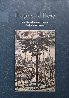
[vc_row css_animation="" row_type="row" use_row_as_full_screen_section="no" type="full_width" angled_section="no" text_align="left" background_image_as_pattern="without_pattern"][vc_column][vc_empty_space height="50px"][/vc_column][/vc_row][vc_row css_animation="" row_type="row" use_row_as_full_screen_section="no" type="grid" angled_section="no" text_align="left" background_image_as_pattern="without_pattern" z_index="" el_class="portfolio-item"][vc_column width="3/12"][vc_single_image image="210" img_size="full" alignment="center" qode_css_animation=""][vc_empty_space height="50px"][/vc_column][vc_column width="9/12"][vc_column_text]EL AGUA EN EL HIERRO J.M. Navarro y C. Soler 1995 Comenzaron en 1988 y duraron hasta 1990. En ellos José Manuel Navarro Latorre...

[vc_row css_animation="" row_type="row" use_row_as_full_screen_section="no" type="full_width" angled_section="no" text_align="left" background_image_as_pattern="without_pattern"][vc_column][vc_empty_space height="50px"][/vc_column][/vc_row][vc_row css_animation="" row_type="row" use_row_as_full_screen_section="no" type="grid" angled_section="no" text_align="left" background_image_as_pattern="without_pattern" z_index="" el_class="portfolio-item"][vc_column width="3/12"][vc_single_image image="201" img_size="full" alignment="center" qode_css_animation=""][vc_empty_space height="50px"][/vc_column][vc_column width="9/12"][vc_column_text]PARQUE NACIONAL DEL TEIDE J.M. Navarro 2000 La dirección del Parque Nacional del Teide encargó a José Manuel la elaboración del mapa geológico, fruto...

[vc_row css_animation="" row_type="row" use_row_as_full_screen_section="no" type="full_width" angled_section="no" text_align="left" background_image_as_pattern="without_pattern"][vc_column][vc_empty_space height="50px"][/vc_column][/vc_row][vc_row css_animation="" row_type="row" use_row_as_full_screen_section="no" type="grid" angled_section="no" text_align="left" background_image_as_pattern="without_pattern" z_index="" el_class="portfolio-item"][vc_column width="3/12"][vc_single_image image="190" img_size="full" alignment="center" qode_css_animation=""][vc_empty_space height="50px"][/vc_column][vc_column width="9/12"][vc_column_text]AVANCE DEL PLAN HIDROLÓGICO INSULAR DE LA PALMA J.M. Navarro y J.J. Coello 1992 Este trabajo consistió en el estudio y redacción de la...

[vc_row css_animation="" row_type="row" use_row_as_full_screen_section="no" type="full_width" angled_section="no" text_align="left" background_image_as_pattern="without_pattern"][vc_column][vc_empty_space height="50px"][/vc_column][/vc_row][vc_row css_animation="" row_type="row" use_row_as_full_screen_section="no" type="grid" angled_section="no" text_align="left" background_image_as_pattern="without_pattern" z_index="" el_class="portfolio-item"][vc_column width="3/12"][vc_single_image image="187" img_size="full" alignment="center" qode_css_animation=""][vc_empty_space height="50px"][/vc_column][vc_column width="9/12"][vc_column_text]AVANCE DEL PLAN HIDROGEOLÓGICO DE TENERIFE J.M. Navarro 1989 En la década de los años 80 del siglo XX, Canarias aprobó una Ley de...

[vc_row css_animation="" row_type="row" use_row_as_full_screen_section="no" type="full_width" angled_section="no" text_align="left" background_image_as_pattern="without_pattern"][vc_column][vc_empty_space height="50px"][/vc_column][/vc_row][vc_row css_animation="" row_type="row" use_row_as_full_screen_section="no" type="grid" angled_section="no" text_align="left" background_image_as_pattern="without_pattern" z_index="" el_class="portfolio-item"][vc_column width="3/12"][vc_single_image image="183" img_size="full" alignment="center" qode_css_animation=""][vc_empty_space height="50px"][/vc_column][vc_column width="9/12"][vc_column_text]BASES PARA EL PLANEAMIENTO HIDROGEOLÓGICO INSULAR J.M. Navarro y I. Farrujia 1989 Este documento comprende los aspectos geológicos e hidrológicos de Tenerife. Para su...

[vc_row css_animation="" row_type="row" use_row_as_full_screen_section="no" type="full_width" angled_section="no" text_align="left" background_image_as_pattern="without_pattern"][vc_column][vc_empty_space height="50px"][/vc_column][/vc_row][vc_row css_animation="" row_type="row" use_row_as_full_screen_section="no" type="grid" angled_section="no" text_align="left" background_image_as_pattern="without_pattern" z_index="" el_class="portfolio-item"][vc_column width="3/12"][vc_single_image image="171" img_size="full" alignment="center" qode_css_animation=""][vc_empty_space height="50px"][/vc_column][vc_column width="9/12"][vc_column_text]MAPA GEOLÓGICO DE LA PALMA J.M. Navarro y J.J. Coello 1993 El mapa geológico fue una de las grandes aportaciones de José Manuel, en...

[vc_row css_animation="" row_type="row" use_row_as_full_screen_section="no" type="full_width" angled_section="no" text_align="left" background_image_as_pattern="without_pattern"][vc_column][vc_empty_space height="50px"][/vc_column][/vc_row][vc_row css_animation="" row_type="row" use_row_as_full_screen_section="no" type="grid" angled_section="no" text_align="left" background_image_as_pattern="without_pattern" z_index="" el_class="portfolio-item"][vc_column width="3/12"][vc_single_image image="165" img_size="full" alignment="center" qode_css_animation=""][vc_empty_space height="50px"][/vc_column][vc_column width="9/12"][vc_column_text]AVANCE DEL PLAN HIDROLÓGICO DE LA GOMERA J.M. Navarro En esta isla, así como para las restantes de esta provincia, realizó la cartografía...

[vc_row css_animation="" row_type="row" use_row_as_full_screen_section="no" type="full_width" angled_section="no" text_align="left" background_image_as_pattern="without_pattern"][vc_column][vc_empty_space height="50px"][/vc_column][/vc_row][vc_row css_animation="" row_type="row" use_row_as_full_screen_section="no" type="grid" angled_section="no" text_align="left" background_image_as_pattern="without_pattern" z_index="" el_class="portfolio-item"][vc_column width="3/12"][vc_single_image image="120" img_size="full" alignment="center" qode_css_animation=""][vc_empty_space height="50px"][/vc_column][vc_column width="9/12"][vc_column_text]INFORME ACERCA DE LA VIABILIDAD DE LA GALERÍA DE MUITA AGUA – ISLA DE SANTIAGO, REPÚBLICA DE CABO VERDE J.M. Navarro y...

[vc_row css_animation="" row_type="row" use_row_as_full_screen_section="no" type="full_width" angled_section="no" text_align="left" background_image_as_pattern="without_pattern"][vc_column][vc_empty_space height="50px"][/vc_column][/vc_row][vc_row css_animation="" row_type="row" use_row_as_full_screen_section="no" type="grid" angled_section="no" text_align="left" background_image_as_pattern="without_pattern" z_index="" el_class="portfolio-item"][vc_column width="3/12"][vc_single_image image="21" img_size="full" alignment="center" qode_css_animation=""][vc_empty_space height="50px"][/vc_column][vc_column width="9/12"][vc_column_text]ESTUDIO GEOLÓGICO DEL PARQUE NACIONAL DE LA CALDERA DE TABURIENTE 1994 J.M. Navarro A comienzos de los años noventa la dirección del Parque Nacional...

[vc_row css_animation="" row_type="row" use_row_as_full_screen_section="no" type="full_width" angled_section="no" text_align="left" background_image_as_pattern="without_pattern"][vc_column][vc_empty_space height="50px"][/vc_column][/vc_row][vc_row css_animation="" row_type="row" use_row_as_full_screen_section="no" type="grid" angled_section="no" text_align="left" background_image_as_pattern="without_pattern" z_index="" el_class="portfolio-item"][vc_column width="3/12"][vc_single_image image="22" img_size="full" alignment="center" qode_css_animation=""][vc_empty_space height="50px"][/vc_column][vc_column width="9/12"][vc_column_text] DEPRESIONES FORMADAS POR DESLIZAMIENTO GRAVITACIONAL EN TENERIFE 1989 J.M. Navarro y J. Coello Este trabajo, del que también es coautor Juan Coello, marcó un...